What is a RegionGrid?
A RegionGrid contains information that:
Allows us to extract gridded lon-lat data for a given
GeoRegion(see GeoRegions.jl) of interest.Subset the relevant longitude/latitude vectors from the initial grid.
Allows for easy spatial-averaging of extracted gridded lon-lat data, weighted by latitude.
RegionGrids.RegionGrid Type
RegionGridAbstract supertype for geographical region gridded information.
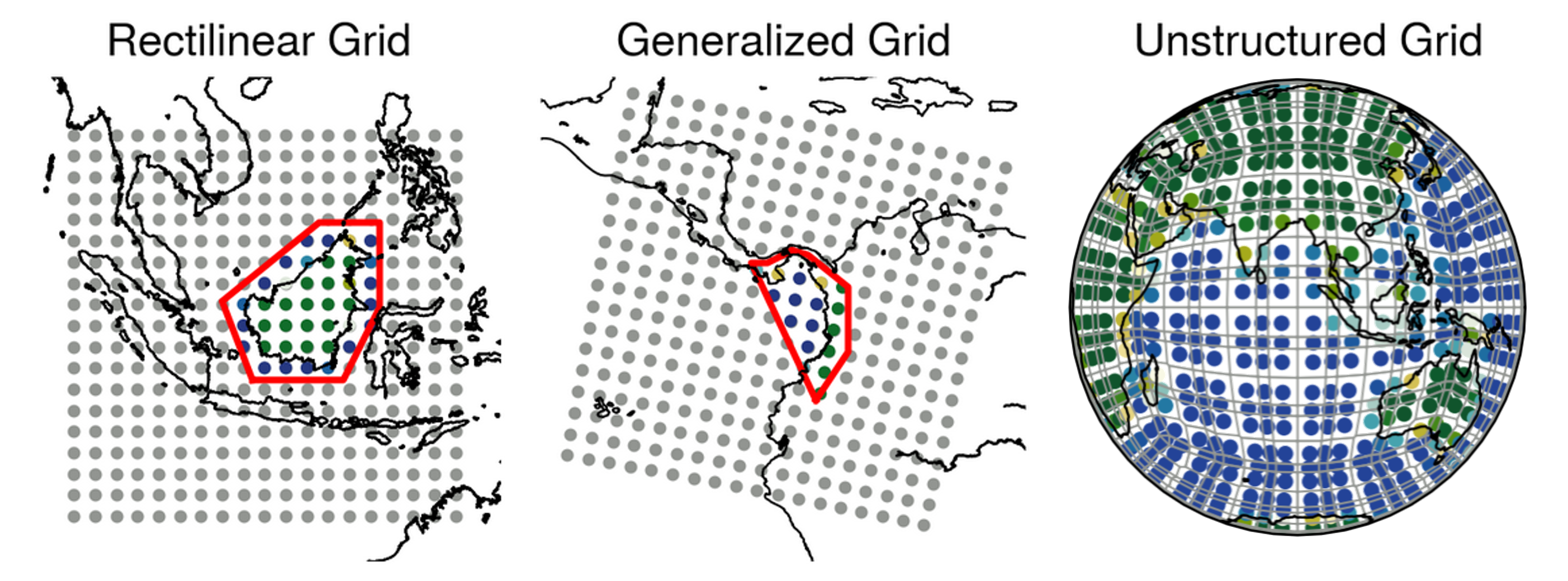
sourceThe Types of RegionGrids
The RegionGrid abstract type has three subtypes:
RectilinearGridtype, which is for the extraction of data on rectilinear lon-lat gridsGeneralizedGridtype, which is for the extraction of data on non-rectilinear lon-lat grids, such as a curvilinear grid.UnstructuredGridtype, which is for the extraction of data on unstructured lon-lat grids such as a cubed-spherical grid, or an unstructured mesh.
Confusing? Fret not, it's always easier to understand by doing, so let's go through an example here.